Verify before you go. Details come from state agency records and may be out of date. Check local conditions, closures and fees with the managing agency before launching. Not for navigation.
O.L. Peacock Park Canoe Launch
Temporarily Closed
| Water body | Peacock Lake |
|---|---|
| Water type | Freshwater |
| County | St. Lucie |
| City | Port Saint Lucie |
| Address / directions | 1950 SW Dreyfus Boulevard |
| Ramp type | Hand Launch Only |
| Amenities | Dock: No Docks; No Accommodations for Accessibility |
| Fee | No |
| Parking | Not Paved - Grass/Loose Soil/Sand; vehicle spaces 24 |
| Hours | Sunrise to Sunset |
| Status | Temporarily Closed |
| Owner / manager | City of Port St. Lucie |
| Agency notes | Status comments: Under Construction- CLOSED - Boating is allowed only for rigid-hulled, non-motorized vessels. Boats must be carried by hand from parking area to water. Grass parking lot. Picnic tables. No other facilities. Gated locked at dusk. Operational comments: Under Construction- CLOSED - Boating is allowed only for rigid-hulled, non-motorized vessels. Boats must be carried by hand from parking area to water. Grass parking lot. Picnic tables. No other facilities. Gated locked at dusk. |
| Source ID | SL68826YL |
| Coordinates | 27.24933, -80.40905 · OpenStreetMap |
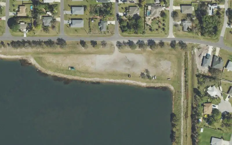
Map
Forecast
Loading forecast…
Source: National Weather Service (api.weather.gov), live.
Nearest water gauge
St Lucie River At Speedy Point, Stuart Fl (USGS 02277100), about 9.7 mi away. It may be on a different water body.
Loading live readings…
Source: U.S. Geological Survey instantaneous values, live, provisional.
Report a change Also tell the agency: corrections to the source data help everyone.
Reviews
No reviews yet.
Nearest listed sites
- Oak Hammock Park and Public Boat Ramp — 2.1 mi
- C-24 Canal Park Boat Ramp - Port St. Lucie — 4.5 mi
- Bessie Creek Public Boat Ramp — 5.1 mi