Verify before you go. Details come from state agency records and may be out of date. Check local conditions, closures and fees with the managing agency before launching. Not for navigation.
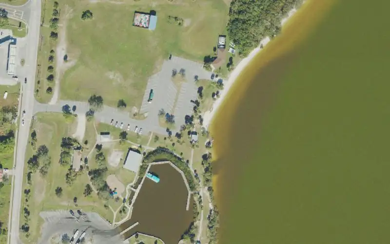
Kelly Park East - Paddlecraft Launch
| Water body | Banana River |
|---|---|
| Water type | Salt or Brackish Water |
| County | Brevard |
| City | Merritt Island |
| Address / directions | 2550 North Banana River Drive |
| Ramp type | Hand Launch Only |
| Lanes | 1 |
| Amenities | Restroom: Flush Toilet; Dock: Observation Dock; No Accommodations for Accessibility |
| Fee | No |
| Parking | Paved - Asphalt or Concrete; vehicle spaces 40 |
| Hours | Dawn to Dusk |
| Status | Open for Business |
| Owner / manager | Brevard County |
| Source ID | BV00007AA |
| Coordinates | 28.40311, -80.66205 · OpenStreetMap |
Map
Forecast
Loading forecast…
Source: National Weather Service (api.weather.gov), live.
Nearest water gauge
St. Johns River Near Cocoa, Fl (USGS 02232400), about 13.0 mi away. It may be on a different water body.
Loading live readings…
Source: U.S. Geological Survey instantaneous values, live, provisional.
Marinas and boat fuel nearby
- Ocean Club Marina Port Canaveral (marina) — 2.0 mi
- Cape Marina (marina) — 2.1 mi
- SpaceX Barge Dock (marina) — 2.5 mi
- Cape Crossing Marina (marina) — 2.8 mi
- Sunrise Marina (marina) — 2.9 mi
Source: © OpenStreetMap contributors (ODbL). Not verified; call ahead.
Report a change Also tell the agency: corrections to the source data help everyone.
Reviews
No reviews yet.
Nearest listed sites
- Kelly Park East - Sailboat Ramp — 0.0 mi
- Kelly Park East - Boat Ramp — 0.1 mi
- Rodney S. Ketchum Ports End Park — 1.9 mi